A quick look at some of the forecast products on the NC State HLSC web page suggests an increasing threat for severe weather on Tuesday morning. While the overall thermodynamic environment appears marginal, recent forecast trends suggest boundary layer moisture and instability will be a little greater than previously expected. Atop the increasing moisture, low and mid-level flow at 50-70kts will result in a strong warm advection pattern and shear.
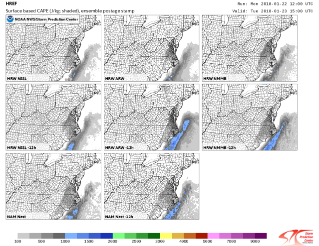
SPC HREF surface based CAPE forecast postage stamps from the 01/22 12 UTC cycle valid at 15 UTC on Tuesday 01/23 shown below indicate only weak instability across eastern NC and eastern VA.
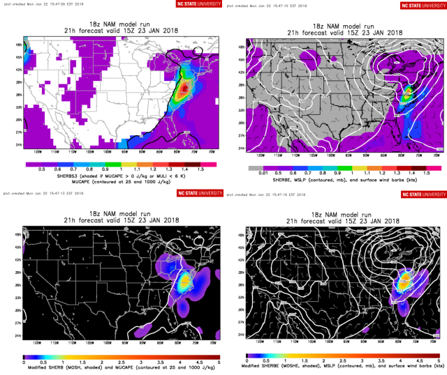
At the same time, the 01/22 18 UTC cycle of the NAM valid at 15 UTC on Tuesday 01/23 shown below highlights northern and northeast NC and especially central and eastern VA for potential severe weather. At 15 UTC, the experimental SHERB and Modified SHERB composite parameters exceed 1 in this region suggestion the potential for HSLC significant severe reports. An introduction to the SHERB is available in this PDF: https://cimmse.wordpress.com/wp-content/uploads/2016/09/sherb.pdf
As a reminder, forecasts of the SHERB/SHERBE and the MOSH/MOSHE products are available for GFS, NAM, and RAP:
In addition, SPC mesoanalysis products for the Mid-Atlantic/Ohio Valley are available for the:
SHERBS3
SHERBE
MOSHE
Finally, as a part of our ongoing efforts to assess and improve the SHERB indices, we ask operational forecasters to submit feedback on the performance of the SHERB and modified SHERB, for both HSLC events and null cases: https://www.meas.ncsu.edu/mdparker/sherb/feedback
